王金亮教授团队学术论文在SCIE三区期刊《PLOS ONE》上线发表
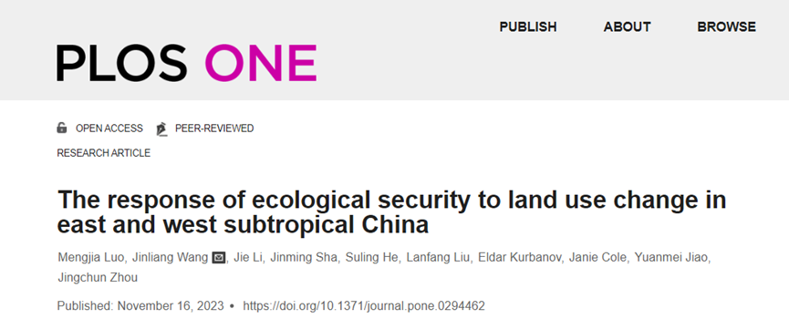
2023年11月16日,以罗梦佳(云南师范大学地理学部地图学与地理信息系统专业2022级硕士研究生)为第一作者,王金亮教授为通讯作者所撰写的题为“The response of ecological security to land use change in east and west subtropical China”的学术论文在SCIE三区期刊PLOS ONE上线发表(https://journals.plos.org/plosone/article?id=10.1371/journal.pone.0294462).

区域土地利用变化与生态安全是近年来全球变化研究的重要领域和热点问题。昆明市和福州市经济快速发展的同时,生态环境遭到不同程度的破坏,开展不同自然带生态安全对土地利用/土地覆盖变化(Land Use/Land Cover Change,LUCC)响应的对比研究,对于区域可持续发展具有重要意义。在谷歌云计算平台(Google Earth Engine,GEE)支持下,采用随机森林和支持向量机法对研究区土地进行了分类,借助Arc GIS平台分析土地利用变化情况;基于驱动力-压力-状态-影响-响应(DPSIR)模型,运用熵权法构建生态安全评价体系,运用灰色关联法对比分析昆明市和福州市生态安全对LUCC响应的异同。结果表明:(1)1995-2020年,昆明市平均综合土地利用动态度为1.05 %、福州市0.55%,昆明市土地利用变化程度高于福州市;(2)1995-2020年,昆明市生态安全指数从0.42上升到0.52,福州市从0.36上升到0.68,两地生态安全水平都在提升,但福州市提升速度更快;(3)LUCC与生态安全之间具有很强的关联性,林地增加对研究区生态安全具有积极作用,建设用地扩张对福州市生态安全水平提升抑制作用明显,水资源状况对昆明市生态安全水平影响较大。
该论文得到了王金亮教授主持的国家重点研发计划政府间国际科技创新合作重点专项:用地理空间技术监测和评估土地利用/土地覆被变化对区域生态安全的影响(2018YFE0184300),国家自然科学资金委员会:联合ULS与TLS点云数据的滇西北天然林单木生物量估算研究(41961060),滇中地区生态安全评价与预警研究(41561048),云南师范大学研究生科研创新基金“利用遥感和GIS技术实现滇中地区生态安全评估与多情景模拟”(项目号:YJSJJ22-B101)的共同资助,
这是罗梦佳同学硕士期间以第一作者发表的第1篇SCIE学术论文(详见录 1,2),也是王金亮教授导师团队 2023年发表的第7篇 SCI/SCIE 论文(详见录 3),让我们恭喜罗梦佳同学!希望她再接再厉!也热烈祝贺团队取好成绩!
附录 1 论文相关信息
标题: The response of ecological security to land use change in east and west subtropical China
作者: Mengjia Luo1,2,3, Jinliang Wang1,2,3 *, Jie Li1,2,3, Jinming Sha4 , Suling He1,2,3 , Lanfang Liu1,2,3, Eldar Kurbanov5, Janie Cole6, Yuanmei Jiao1,2,3, Jingchun Zhou1,2,3
通讯作者:Jinliang Wang
作者单位:
1 Faculty of Geography, Yunnan Normal University, Kunming, China
2 Key Laboratory of Resources and Environmental Remote Sensing for Universities in Yunnan, Kunming, China
3 Remote Sensing Research Laboratory, Center for Geospatial Information Engineering and Technology of Yunnan Province, Kunming, China
4 College of Geographical Science, Fujian Normal University, Fuzhou, China
5 Center for Sustainable Forest Management and Remote Sensing, Volga State University of Technology, Yoshkar-Ola, Russia
6 Council for Geoscience, Pretoria, South Africa
* Corresponding author:
E-mail: jlwang@ynnu.edu.cn (JW)
出版物:PLOS ONE(2021年12月基础版三区,2022年12月最新升级版三区,2023年最新IF:3.7)
摘要:Regional land use change and ecological security have received considerable attention in recent years. The rapid economic development of Kunming and Fuzhou has resulted in environmental damage such as water pollution and urban heat island effect. It is thus important to conduct a comparative analysis of the ecological security response to land use/land cover change (LUCC) in different natural zones. Using the Google Earth Engine (GEE) platform, random forest and support vector machine methods were used to classify land cover types in the study area, after which the ArcGIS platform was used to analyze LUCC. The driving force-pressure-state-impact-response (DPSIR) model and entropy weight method were used to construct an ecological security evaluation system, and gray correlation was used to compare the ecological security responses to LUCC in Kunming and Fuzhou. The findings revealed that: (1) The average dynamic degrees of comprehensive land use in Kunming and Fuzhou from 1995 to 2020 were 1.05% and 0.55%, respectively; (2) From 1995 to 2020, the ecological security index values for Kunming and Fuzhou increased from 0.42 to 0.52 and from 0.36 to 0.68, respectively, indicating that Fuzhou’s index is rising more rapidly; and (3)There is a strong correlation between LUCC and ecological security, the correlation between the woodland and the ecological security index is very strong in both places. The expansion of construction land may be an important reason for the reduced ecological security level in Fuzhou City, while water resources have a significant impact on the ecological security level of Kunming City.
关键字:LUCC; Ecological security; DPSIR model; GEE; Random forest
附录2 罗梦佳同学发表论文清单
[1] Luo M, Wang J, Li J, Sha J, He S, Liu L, et al. (2023) The response of ecological security to land use change in east and west subtropical China. PLoS ONE 18(11): e0294462. https://doi.org/10.1371/journal.pone.0294462
附录 3 王金亮教授团队 2023 年发表论文清单
自2023年01月01日至11月18日,王金亮教授导师团队发表学术论文11篇,其中SCIE论文7篇,CSCD3篇,普刊1篇。具体信息如下:
[11] Luo M, Wang J, Li J, Sha J, He S, Liu L, et al. (2023) The response of ecological security to land use change in east and west subtropical China. PLoS ONE 18(11): e0294462. https://doi.org/10.1371/journal.pone.0294462(2021年12月基础版三区,2022年12月最新升级版三区,2023年最新IF:3.7)
[10]Sikai Wang, Suling He, Jinliang Wang *, Jie Li, Xuzhen Zhong, Janine Cole, Eldar Kurbanov, Jinming Sha. Analysis of Land Use/Cover Changes and Driving Forces in a Typical Subtropical Region of South Africa[J], Remote Sensing. 2023,15(19): 4823. https://doi.org/10.3390/rs15194823 (2021年12月基础版二区,2022年12月最新升级版二区,2023年最新IF:5.349)
[9] Hong Zhu, Feng Cheng, Jinliang Wang*, Yuanmei Jiao, Jingchun Zhou, Jinming Sha, Fang Liu, and Lanping Nong. Variation in the Ecological Carrying Capacity and Its Driving Factors of the Five Lake Basins in Central Yunnan Plateau, China[J]. Sustainability 2023, 15, 14442. https://doi.org/10.3390/su151914442(中科院SCI期刊分区:2021年12月基础版三区,2022年12月最新升级版三区,2023年最新IF3.889)
[8] 邵大江,叶辉,王金亮*,周京春,角媛,沙晋明. 基于机器学习均值化的地质灾害易发性评价[J]. 云南大学学报(自然科学版), 2023, 45(3): 653-665. DOI:10.7540/j.ynu.20220109. (CSCD核心库)
[7] Jie Li, Hui Wang, Jinliang Wang*, Jianpeng Zhang, Yongcui Lan, Yuncheng Deng. Combining Multi-Source Data and Feature Optimization for Plastic-Covered Greenhouse Extraction and Mapping Using the Google Earth Engine: A Case in Central Yunnan Province, China [J]. Remote Sensing, 2023, 15, 3287. DOI: https:// doi.org/10.3390/rs15133287. (中科院SCI期刊分区:2021年12月基础版二区,2022年12月最新升级版二区Top,2023年最新IF5.349)
[6]张建鹏;王金亮*;刘广杰;麻卫峰;刘钱威;邓云程. 基于地基雷达点云主方向的林下植被自动滤除[J], 遥感技术与应用, 2023,38(2):405-412. DOI:10.11873/j.issn.1004-0323.2023.2.0405 (CSCD核心库)
[5]何苏玲,贺增红,潘继亚,王金亮*.基于多模型的县域土地利用/土地覆盖模拟[J/OL].自然资源遥感. 2023-04-03网络首发. https://kns.cnki.net/kcms/detail/10.1759.P. 20230331.1810.004.html (CSCD核心库)
[4]成钊,王金亮*,何苏玲,祁兰兰. 基于多源数据的滇中地区生态韧性度研究[J]. 云南地理环境研究, 2023, 35(02):7-16
[3] Jianpeng Zhang, Jinliang Wang*, Weifeng Ma, Yuncheng Deng, Jiya Pan, Jie Li. Vegetation Extraction from Airborne Laser Scanning Data of Urban Plots Based on Point Cloud Neighborhood Features [J]. Forests, 2023, 14(4), 691. DOI: https://doi.org/10.3390/f14040691. (中科院SCI期刊分区:2021年12月基础版三区, 2022年12月最新升级版二区,2022年IF 3.282)
[2] Jun Ma, Jianpeng Zhang, Jinliang Wang *, Vadim Khromykh, Jie Li, Xuzheng Zhong. Global Leaf Area Index Research over the Past 75 Years: A Comprehensive Review and Bibliometric Analysis [J]. Sustainability, 2023. DOI: https://doi.org/10.3390/su15043072. (中科院SCI期刊分区:2021年12月基础版三区,2022年12月最新升级版三区,2022年IF 3.889)
[1] Lei Liang, Jinliang Wang*, Fei Deng, Deyang Kong. Mapping Pu'er tea plantations from GF-1 images using Object-Oriented Image Analysis (OOIA) and Support Vector Machine (SVM) [J]. PLOS ONE, 2023. DOI: https://doi.org/10.1371/journal.pone. 0263969. (中科院SCI期刊分区: 2021年12月基础版三区,2022年12月最新升级版三区,2022年IF 3.752)
(云南省高校资源与环境遥感重点实验室 供稿)
地址:云南省昆明市呈贡区云南师范大学旅游与地理科学学院413
邮箱:ynnurs@163.com 电话:0871-65941202 技术支持:蓝队云
版权所有:Copyright © 2016-2018 云南省高校资源与环境遥感重点实验室. All Rights Reserved